Google Street View App is a technology featured in Google Maps and Google Earth that provides panoramic views from positions along many streets in the world. It explores world landmarks, discovers natural wonders, and step inside locations such as museums, event arenas, and small businesses with Street View. It was launched in 2007 in several cities in the United States and has since expanded to include cities and rural areas worldwide.
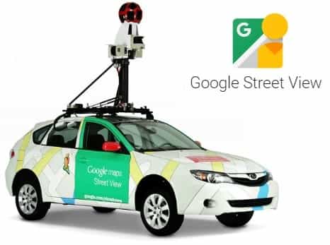
Most photography is done by car, but some are done by trekker, tricycle, walking, boat, snowmobile, and underwater apparatus. Google Street View is available as a component of Google Maps, as a web application, and as a mobile application for Android and iOS. So you can use Street View on Google Maps, the Street View gallery, or the Street View app.
The Feature of Google Street View
- Explore world landmarks, discover natural wonders, and step inside locations such as museums, arenas, restaurants, and small businesses with Google Street View.
- You can also add your own Street View for everyone to see.
- Create 360 photos using either your phone’s camera or a certified Street View Ready camera, then position them and add connections on the map using the Street View app.
- New for Local Guides level 6+ and Street View Trusted Photographers:
Try the new “Video Mode” beta, where you can connect a Ricoh Theta V camera and create Street View as you walk, bike, or drive. This new mode records video from your camera and converts it into connected Street View images when you publish to Google Maps.
Smart Navigation introduced allowing users to navigate around the panoramas by double-clicking with their cursor on any place or object they want to see. Google invites users to contribute panoramas of their own using gadgets with Android 4.2. Google highlights user-contributed panoramas with blue circle icons on Maps.
Google allows users to create their own street view-like blue paths, for the connected photospheres that are sufficiently close to one another.
Here’s how you can see Street View photos:
- Search for a place or address in Google Maps.
- Drag Pegman to a place on the map.
- Search for a place or address in Google search.
Download App: Click Here